



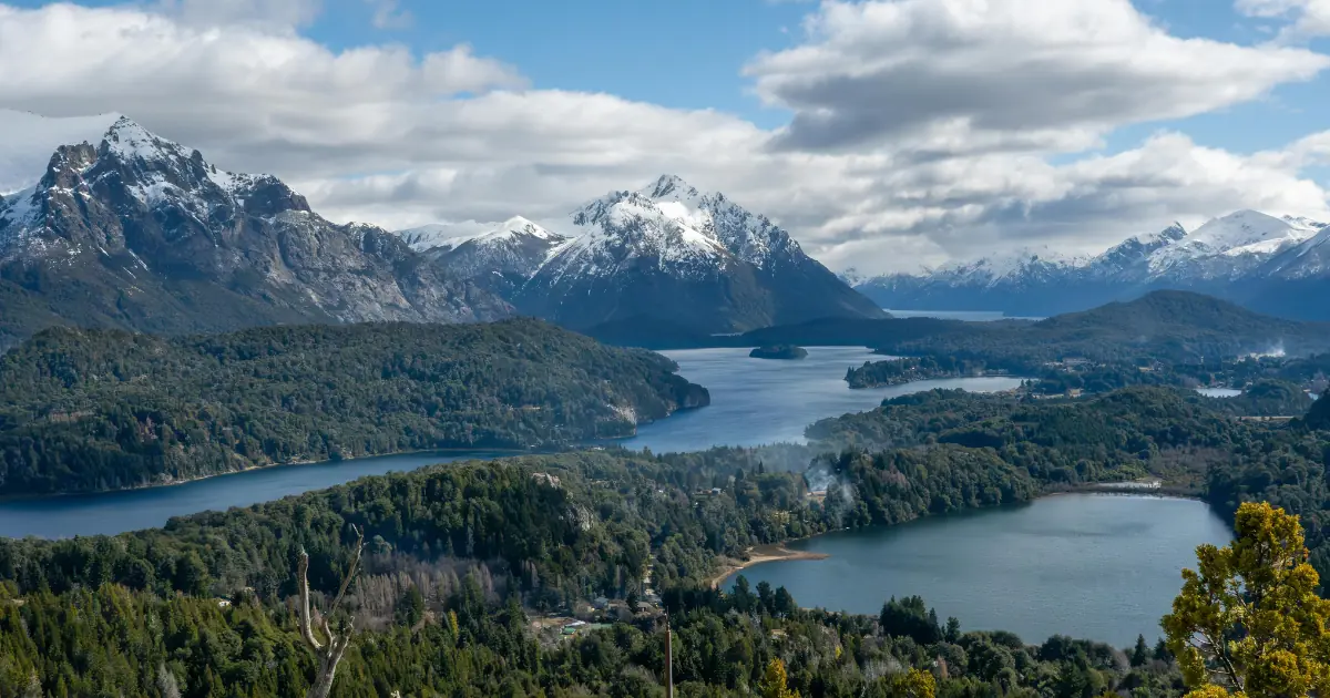
Is Patagonia a country? No. Patagonia is a region at the southern end of South America, and it belongs to two countries: Argentina and Chile. What matters for a trip is not the label but what happens at the line between them, because the line changes your passport stamp, your currency, the food you can carry and sometimes your clock.
This guide answers the question in one paragraph and then spends the rest of the page on the part that other guides skip: which base sits in which country, what changes when you cross, and where the crossings are. If you are still deciding when to go, start with our guide to the best time to visit Patagonia and come back once you have a month.
Is Patagonia a country or a region?
Patagonia is a geographic region, not a state. It has no government, no capital, no official flag and no passport control of its own. Argentina holds the larger eastern share and Chile holds the western edge along the Pacific, and each country governs its own side through its own provinces or regions. Argentina’s national tourism board makes the same point: Patagonia is a natural region spread across both countries, and each one manages its part.
So the question “what is the difference between Patagonia and Argentina?” has a short answer. Argentina is a country, and Patagonia is a region that is partly inside it. The same is true of Chile. If you want the map, the borders of the region and the distance between bases, that lives in our guide to where Patagonia is. Here we stay with what the split means once you are on the ground.
What country is Patagonia in? Base by base
Most travellers do not ask about the region as a whole. They ask about one town, and the town sits in one country. This table lists the bases people ask about most.
| Base | Country | Province or region |
|---|---|---|
| Bariloche | Argentina | Río Negro |
| Puerto Madryn | Argentina | Chubut |
| El Calafate | Argentina | Santa Cruz |
| El Chaltén | Argentina | Santa Cruz |
| Ushuaia | Argentina | Tierra del Fuego |
| Coyhaique | Chile | Aysén |
| Puerto Natales | Chile | Magallanes |
| Punta Arenas | Chile | Magallanes |
| Torres del Paine National Park | Chile | Magallanes |
The Patagonia First-Timer's Guide
Download the practical side of Patagonia in one guide: real driving times between bases, how park tickets and discounts work, what you can't take across into Chile, and a worksheet to get a sharper quote.
Is Patagonia in Argentina?
Yes, most of it. Argentine Patagonia is the eastern and larger share, and it holds Bariloche and the northern lakes, the Atlantic coast around Puerto Madryn, the Perito Moreno Glacier near El Calafate, the granite towers above El Chaltén and Ushuaia on Tierra del Fuego. The glaciers and the towers are inside Los Glaciares National Park, which Argentina’s national parks administration runs.
Is Patagonia in Chile?
Yes, the western edge. Chilean Patagonia is a narrow strip of fjords, forest and the Pacific side of the ice fields. It holds Punta Arenas, Puerto Natales and Torres del Paine National Park, which CONAF, the Chilean national forestry corporation, manages. The most visited Patagonian park in each country therefore answers to a different agency with different rules.
Two bases show why the split matters for planning. El Calafate and Puerto Natales are only about 155 km apart in a straight line, which is why they pair so well, yet they are in different countries. Ushuaia and Punta Arenas are both on the southern tip, and again each one belongs to a different country.
What changes when you cross from Argentina into Chile?
For a traveller with a United States passport, less than you might fear, and more than nothing. This table sets the two sides next to each other.
| What | Argentina | Chile |
|---|---|---|
| Entry on a U.S. passport | No visa for visits of 90 days or less | No visa for 90 days or less, with a tourist card issued on arrival that you return when you leave |
| Proof of funds | Not listed by the U.S. Department of State | At least US$46 per day, according to the same source |
| Currency | Argentine peso | Chilean peso |
| National parks run by | Administración de Parques Nacionales | CONAF |
| Day ticket for a foreign adult at the flagship park | Los Glaciares, ARS 50,000, about US$32 | Torres del Paine, CLP 32,400, about US$33 |
The entry rules come from the U.S. Department of State country pages for Argentina and Chile, updated in July 2026. The park tickets come from Argentina’s parks administration, Resolution 157/2026, in force since 1 June 2026, and from CONAF, whose fees changed on 1 May 2026. Dollar figures are references at late September and early October 2026 exchange rates, so the amount charged at the gate is the one that counts.
Four details do not fit in a table.
- Passport validity. Both countries expect the passport to be valid when you enter, with at least one blank page for stamps. Check the expiry date before you book flights, not after.
- The Chilean tourist card. Chile keeps its own record of your stay. Overstaying brings a fine, and you cannot leave until it is paid. An extension costs US$100 at the Chilean immigration office, according to the same State Department page.
- Food. Chile asks you to declare every product of plant or animal origin when you enter, according to its government portal, consulted in October 2026. An undeclared product can bring a fine, and inspectors use hand checks, X-ray and detector dogs. Declare the sandwich you packed in El Calafate. It is faster than explaining it later.
- The clock. Argentina’s official time is three hours behind UTC, according to Law 26,350. Magallanes, the Chilean region around Punta Arenas and Puerto Natales, is fixed at the same offset permanently by Chile’s Decree 143 of 2022, so crossing there does not change your watch. The rest of continental Chile uses winter time four hours behind UTC and moves one hour forward in summer, so for part of the year it runs one hour behind Argentina.
Where do you cross the border in Patagonia?
Argentina and Chile share many land crossings. Chile’s border agency lists them on its official site, with the nearest town, the access road and the vehicle types allowed. These four cover most Patagonian trips.
| Crossing | Nearest town on the Chilean side | Chilean access road | Note |
|---|---|---|---|
| Dorotea | Puerto Natales | Not listed | Open to all types of vehicles, at 605 m |
| Integración Austral | Punta Arenas | Ruta 255 | Open to all types of vehicles, at 163 m |
| San Sebastián | Porvenir | Ruta 71 Y | Open to all types of vehicles, at 17 m; the crossing on Tierra del Fuego |
| Cardenal Samoré | Osorno | Ruta 215 CH | Open to all types of vehicles, at 1,305 m; the lake district crossing |
We do not print opening hours here, because Chile’s official crossing pages do not list them. Crossings can close for weather or maintenance, so check the agency’s alerts page the day before you travel, and ask the operator or the rental company, not a forum.
Tierra del Fuego deserves its own warning. According to Argentina’s national tourism board, reaching it by road from the mainland means a ferry across the Strait of Magellan through Chilean territory. The island itself is split between the two countries, so the road to Ushuaia leaves Argentina, crosses into Chile, and returns to Argentina. If you rent a car, ask in writing whether the contract allows it to cross, because a rental that stops at the border is a common surprise.
One trip or two? How to plan around the border
Most first trips use one gateway city, one country at a time and one crossing at most. A route that links El Calafate, El Chaltén and Torres del Paine crosses once. One that adds Ushuaia and Punta Arenas by land crosses several times and spends days on the road.
Use the border as a planning unit:
- Choose the bases first. Our Patagonia itinerary guide shows how bases turn into days.
- Count the crossings. Each one costs time at the line, and some bases are easier to reach by air than by road.
- Check the documents once. Passport validity, the tourist card and the food rule are the same on every crossing.
- Leave a margin day for a crossing that closes.
If you are already comparing routes, tell us when you travel and who is coming. We run trips across Argentina, Chile, Brazil and Peru, and real people are on call from the first message to check which crossing and which gateway fit your dates.

Due to my professional background, I have extensive skills in the identification and characterization of target audiences, which allows me to understand the needs, preferences and specific behaviors of each segment, in order to design effective strategies that contribute to the success of the organization’s communication goals.
I work in the creation of digital content and the design of narratives for companies in the travel and tourism sector, contributing significantly to the promotion of destinations, services and exclusive experiences, generating a positive impact on brand perception.
Throughout my career, I have acquired solid experience in project planning and management, and I am passionate about research and data analysis, especially oriented to the development of user-centric products.
My experience encompasses the development and implementation of sustainable practices in processes, for building solutions that generate positive impact both socially and environmentally.
Always committed to designing effective solutions, I am dedicated to address challenges and contribute to the growth and development of teams and organizations with a holistic and sustainable approach.

0 Comment