



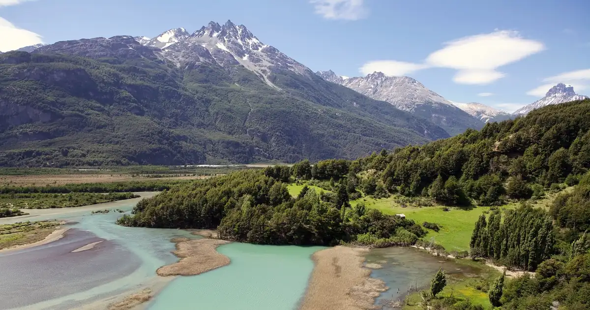
Patagonia Chile is not one place. It is a strip of land along the Pacific side of the Andes so long that Sernatur, Chile’s national tourism service, links 17 national parks along a 2,800 km route from Puerto Montt to Cape Horn, according to its official site, consulted in October 2026. The strip splits into three regions, and each one has its own airport, its own road logic and its own season.
This guide gives you those three regions in order, with the airport, the distances and the number of days each one needs. Topics we already cover in depth stay in their own guides: Torres del Paine, where Patagonia is on a map and what changes at the border. If you are still choosing a month, start with our guide to the best time to visit Patagonia and come back once you have a window.
What is Patagonia Chile? Three regions, north to south
Most people picture one famous park when they search for Patagonia Chile. The reality is a chain of three regions, and the useful planning question is which one you want, because they do not share an airport.
| Region | Gateway airport | Known for | Days: minimum | Days: comfortable |
|---|---|---|---|---|
| Lakes (Los Lagos) | Puerto Montt, El Tepual (PMC) | Lake Llanquihue, Puerto Varas, Vicente Pérez Rosales National Park | 2 | 4 |
| Aysén and the Carretera Austral | Balmaceda (BBA), near Coyhaique | A long gravel road, Queulat, the Marble Caves, Caleta Tortel | 4 | 7 |
| Magallanes | Punta Arenas (PUQ) | Torres del Paine, Magdalena Island penguins, the Strait of Magellan | 4 | 7 |
What Patagonia Chile is known for depends on the region. The Lakes are known for a volcano reflected in a lake, Aysén for a road that follows glaciers and fjords, and Magallanes for the granite towers of Torres del Paine and a penguin colony within reach of Punta Arenas. Because the three share a country but not a map, a trip that tries to taste all of them mostly collects airport transfers.
Sernatur lists exactly these three airports as the access points to its park route. The day counts are our own recommendation, built from the distances below, and they assume you stay in one region per trip. The next three sections take the regions one by one.
Northern Patagonia Chile: the Lakes region as a doorway
The Lakes region is the gentlest start. Puerto Montt’s El Tepual airport has direct flights from Santiago, and Sernatur puts the flight at 1 hour 45 minutes. From the airport it is 22 km, about 30 minutes, to Puerto Varas, and 40 km, about 50 minutes, to Frutillar.
What you come for is water and volcano views rather than ice: Lake Llanquihue, Vicente Pérez Rosales National Park, Lake Todos los Santos and the Andean Crossing, all listed by Sernatur. It is also the place where Chilean Patagonia begins in practice, because the Carretera Austral starts at Puerto Montt.
The Patagonia First-Timer's Guide
Download the practical side of Patagonia in one guide: real driving times between bases, how park tickets and discounts work, what you can't take across into Chile, and a worksheet to get a sharper quote.
Two days is enough for the lake and a park day. Four gives you a slower pace and a second lake. We treat this region as the doorway to the south, and our guide to the Patagonian Lake District on both sides of the border covers the wider region.
The Carretera Austral: Aysén and the road south
Route 7, the Carretera Austral, runs for more than 1,200 km from Puerto Montt to Villa O’Higgins, according to Sernatur. The page also warns that parts of it are gravel and recommends an all-terrain vehicle. This is the part of Patagonia Chile where distance, not sights, decides your days.
Sernatur’s own routes make the arithmetic visible:
| Sernatur itinerary | Total distance | Days | Average per day |
|---|---|---|---|
| Seven days, from Puerto Montt airport to Balmaceda airport | 1,089 km | 7 (6 driving days) | about 180 km |
| Three days in Aysén: Marble Caves, Queulat and Caleta Tortel | 879 km | 3 | about 290 km |
The average per day is our calculation from those two totals, counting the six days of the seven day route that Sernatur spends on the road. It shows the trade: the three day version packs about 290 km into each day, while the seven day version leaves room for walks. The seven day route also includes a boat ride of about 1 hour 30 minutes to the Marble Caves from Puerto Río Tranquilo, which Sernatur says is best done with a tour operator.
The parks are the reason to go that far: Pumalín Douglas Tompkins, Queulat, Patagonia and Laguna San Rafael national parks are the four Sernatur highlights. From Coyhaique, Queulat is about 170 km and the Marble Caves area is 223 km south, according to Sernatur’s Aysén route. Balmaceda airport is 55 km from Coyhaique.
Two logistics points matter more than the sights. Sernatur names Caleta La Arena and Puerto Yungay as key ferry points, and it says the Ruta Bimodal ferries should be booked well in advance. It also warns of constant rain even in summer, strong wind on the southern lakes and towns without ATMs or reliable internet, so carry cash.
We recommend four days at the very least, to cover Coyhaique, Queulat and the Marble Caves without rushing, and seven if you want the road to feel like a trip rather than a transfer.
Southern Patagonia Chile: Magallanes beyond Torres del Paine
Magallanes is the region most travellers already know through one park. Punta Arenas is its gateway, with direct flights from Santiago and a 20 km transfer into town. Puerto Natales is 250 km north on Route 9, about 3 hours by intercity bus, according to Sernatur.
Everything about the park itself, from the three entrances to the 2027 airport works, lives in our Torres del Paine guide, and the multi day routes are in our guide to the W trek. Here we cover what surrounds it, which is what makes Magallanes worth a week.
The easiest addition is the penguins of Los Pingüinos Natural Monument. Boat tours leave from the port of Punta Arenas to Magdalena Island, 35 km northeast of the city, and Sernatur says the tour must be registered with it. CONAF, the national forestry corporation, gives the rules: about 7,000 pairs of Magellanic penguins nest on the island, visits are possible from October to mid April, landings run from 09:00 to 18:00, and visitors may spend at most one hour on the island on a 1.4 km trail with a certified guide. CONAF’s page also notes the monument is closed in winter.
Sernatur’s Punta Arenas page also lists Francisco Coloane Marine Park, Pali Aike National Park, the San Isidro lighthouse and Puerto Williams, which is a separate trip south.
Count Punta Arenas as two days on its own, one for Magdalena Island and one for the city and the Strait. Add the road to Puerto Natales and your Torres del Paine days from our guide, and four days is the floor and seven a comfortable week.
How many days do you need in Patagonia Chile?
The minimum column in the first table adds up to ten days if you tried all three regions, and the comfortable column to eighteen. That is the point: Patagonia Chile is better planned as one region per trip, or as two regions with a flight between them.
The first day usually decides the trip, so here is the road from each airport to its first base, from Sernatur’s official pages:
| Airport | First base | Distance | Time |
|---|---|---|---|
| Puerto Montt (PMC) | Puerto Varas | 22 km | about 30 minutes |
| Puerto Montt (PMC) | Frutillar | 40 km | about 50 minutes |
| Balmaceda (BBA) | Coyhaique | 55 km | Not listed |
| Punta Arenas (PUQ) | Punta Arenas city | 20 km | Not listed |
| Punta Arenas (PUQ) | Puerto Natales | 250 km | about 3 hours by bus |
From the Lakes airport you reach a first base in under an hour, Punta Arenas is only 20 km from its airport, Puerto Natales adds about three hours of bus, and the Carretera Austral starts with a transfer before the road itself. Plan arrival days as travel days, and keep your first morning free.
Use these rules:
- Choose by what you want to see. Lakes and volcanoes point north, a gravel road and hanging glaciers point to Aysén, and granite towers and penguins point to Magallanes.
- Enter and leave through the same region’s airport when you can. Sernatur lists a separate airport for each region, which is a hint about how the geography works.
- Add a margin day in Aysén. Ferries, rain and gravel decide that route more than the clock.
- Do not stack three regions into ten days. The distances above leave no time to see anything properly.
For a day by day plan that links bases, our Patagonia itinerary guide shows how the days fit together.
When to visit Patagonia Chile
Sernatur’s Carretera Austral page names December to March as the best months, its seven day itinerary says spring and summer, and it lists spring and summer for the penguin colony. The same months overlap with the summer hours of Torres del Paine, which run from October to April. Sernatur describes Punta Arenas as cold and windy all year and warns of constant rain on the Carretera Austral even in summer, so pack for cold and wet even in January. Winter is possible but narrower. Torres del Paine runs shorter hours from May to September, from 08:00 to 18:30, and CONAF notes that the Los Pingüinos monument is closed in winter, so a May to September trip leaves out the penguins. For wind, sun and snow by month, use our best time to visit Patagonia guide, which is built from Argentina’s national weather service records.
Patagonia Chile and Argentina: how the two sides fit
You do not have to choose one country. El Calafate and Puerto Natales are only about 155 km apart in a straight line, which is why they work as a pair, and our where Patagonia is guide shows the distances between nine bases. The border crossings, the paperwork and the clock change are in our guide on whether Patagonia is a country.
Planning Patagonia Chile in one page
- Pick the region. Lakes, Aysén or Magallanes, with their own airport each: Puerto Montt, Balmaceda or Punta Arenas.
- Pick the days. Two to four in the Lakes, four to seven on the Carretera Austral, four to seven in Magallanes.
- Check the season. Spring and summer. Sernatur names December to March as the best months for the Carretera Austral, and penguin visits run from October to mid April.
- Book the ferries and the boats early. Sernatur says the Ruta Bimodal ferries should be booked well in advance, and the Magdalena Island tours must be registered with it.
If you already have dates, tell us when you travel and who is coming, and we will check which region and which days fit.

Due to my professional background, I have extensive skills in the identification and characterization of target audiences, which allows me to understand the needs, preferences and specific behaviors of each segment, in order to design effective strategies that contribute to the success of the organization’s communication goals.
I work in the creation of digital content and the design of narratives for companies in the travel and tourism sector, contributing significantly to the promotion of destinations, services and exclusive experiences, generating a positive impact on brand perception.
Throughout my career, I have acquired solid experience in project planning and management, and I am passionate about research and data analysis, especially oriented to the development of user-centric products.
My experience encompasses the development and implementation of sustainable practices in processes, for building solutions that generate positive impact both socially and environmentally.
Always committed to designing effective solutions, I am dedicated to address challenges and contribute to the growth and development of teams and organizations with a holistic and sustainable approach.

0 Comment